- Home
- Symmetry Blog
- What is a LiDAR Drone System?
What is a LiDAR Drone System?
About Jari Haiston
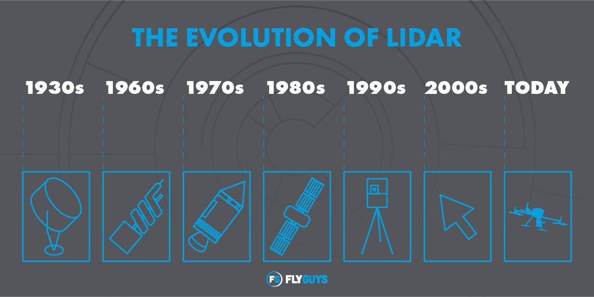
The idea of Light Detection and Ranging (LiDAR) was first introduced in 1930 when E.H. Synge proposed using light pulses to measure distance. First used to study the atmosphere, it wasn’t until the 1960s when the first official LiDAR prototypes emerged.
Fast forward to today, and LiDAR has become an essential tool for precision mapping, autonomous navigation, infrastructure inspection, and more. From aerial drones to autonomous vehicles, it has evolved into a versatile solution that generates real-time, high-fidelity 3D data through dense point clouds. A LiDAR drone system is a UAV equipped with a LiDAR sensor, a high-precision GNSS, and supporting components like IMUs, data loggers, and communication modules.
The integration of LiDAR in unmanned aerial vehicles (UAVs) has transformed the way engineers, developers, and researchers approach terrain modeling, volumetric analysis, and change detection. LiDAR’s capabilities bring centimeter-level accuracy to even the most rugged and remote environments.
LiDAR vs Photogrammetry Modelling
In drone-based 3D mapping, the two most widely used technologies are LiDAR and photogrammetry. Both are powerful remote sensing technologies capable of generating 3D models, but they operate on fundamentally different principles and serve different types of applications.
Photogrammetry works by extracting spatial measurements from 2D photographs. In drone applications, this involves flying a UAV equipped with a standard RGB camera to capture a series of overlapping images from various angles. From there, software identifies shared visual features to triangulate a 3D model or point cloud using structure from motion algorithms.
In contrast, LiDAR is an active sensing technique. It emits rapid laser pulses and measures the time it takes for each pulse to reflect from surfaces below. Since LiDAR provides its own light source, LiDAR systems can operate in complete darkness. While photogrammetry can be adapted to operate in low-light conditions (infrared cameras), it still depends heavily on good weather and ambient light for high-quality imaging.
Unlike photogrammetry, LiDAR can penetrate gaps in foliage and accurately map sparse or obscured environments by directly measuring distance points.
Why Choose LiDAR?
Choosing between LiDAR and photogrammetry as an integrated solution usually comes down to design requirements, accuracy goals, and budget.
- Photogrammetry offers a lower cost of entry and is well-suited for projects that need visually rich, color-accurate models.
- LiDAR, while initially more expensive, typically provides superior accuracy and speed for applications requiring precise location intelligence.
Another key difference between the two technologies lies in data processing. LiDAR data usually results in a raw point cloud that is immediately available for georeferencing and analysis. Photogrammetry, by contrast, involves stitching together hundreds or sometimes thousands of images, a time-consuming process that is computationally intensive.
Ultimately, LiDAR is ideal in applications where precision, terrain penetration, or low-light capability is critical, like topographic surveying, infrastructure inspection, and vegetation analysis. However, photogrammetry remains a strong, cost-effective solution for projects prioritizing detail and accessibility such as, architectural renderings, construction site monitoring, or marketing visuals.
Key Components for a High-Precision LiDAR Drone Design
Developing a reliable, accurate, and efficient LiDAR-equipped drone requires more than just mounting a sensor to an UAV. Such designs demand a system-level approach with robust connectivity, real-time positioning, reliable computational power, and environmental awareness.
u-blox has a robust line of High Precision GNSS (HPG) solutions that help developers achieve up to cm-level accuracy in seconds. Their HPG portfolio is ideal for applications that demand ultra-specific navigation precision like industrial UAVs.
LiDAR systems rely on highly synchronized GNSS and IMU data to calculate the exact position of each laser pulse. Without precision GNSS, a point cloud could drift to positional inaccuracies.
With an integrated NVIDIA® Jetson AGX Orin™ module, the RoScube-X RQX-59 Series from ADLink is an ROS 2 robotic controller designed to meet the rigorous demands of robotics and autonomous systems. The RQX-590 is also equipped with an integrated NVIDIA CUDA® GPU alongside dual deep learning accelerators for high-speed AI processing.
Supporting a diverse range of camera inputs, including GMSL1/2 and FPD-Link III, the RQX-590 delivers unparalleled flexibility to push the boundaries of what’s possible in robotics.
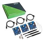
Digi XBee® XR 900 and Digi XBee® XR 868 are next -gen modules from Digi International that offer sub-GHz, long-range RF communication in even the most rugged environments. Their low latency speeds enable efficient communication between a drone and ground station for real-time tracking, mission-critical updates, or even downlinking preview data mid-flight.
With line-of-site ranges of up to 17km, these modules are ideal for extended-range applications where consistent, long-distance connectivity is non-negotiable.
Airgain’s line of Nimbelink Skywire® 4G LTE Cat 4 and Cat 1 WW Embedded Cellular Modems deliver seamless cellular connectivity in compact, drone-ready packages. Their robust connectivity enables real-time data streaming, cloud-based analytics, and remote monitoring.
Skywire® embedded solutions are pre-certified with major carriers like AT&T and Verizon for easy deployment. Supporting GNSS, dual SIMs, and integrated TCP/IP stacks, Skywire® solutions accelerate time to market for a wide range of connected designs.
Gigadevice MCUs are well-equipped to handle complex sensor fusion (GNSS + IMU), and mission logic, and system coordination in UAV platforms. The GD32 family is a line of high-performance ARM Cortex-M4 MCUs with floating-point and DSP support, making them a solid fit for compute-efficient, low-power applications like drone flight control, telemetry, and peripheral integration.
Drone Design Solutions Available at Braemac Americas
At Braemac Americas, we offer a comprehensive portfolio of advanced technologies to power next-generation drone systems. Whether you're building a high-precision LiDAR platform or scaling up for AI-driven edge processing, our solutions—from ADLINK’s edge-AI LiDAR integration to Aetina’s high-performance AI computing modules—are engineered to meet the demands of modern aerial systems. With deep technical expertise and a curated linecard of trusted suppliers, Braemac Americas is your partner in building smarter, more capable UAV platforms that deliver actionable location intelligence from the sky down.
Stay up-to-date on the latest breakthroughs, products, and trends by subscribing to Braemac Americas’ newsletter!





.jpg)
